Austria issues weather warning for gale-force winds and icy conditions
The Austrian meteorological service has issued an alert for severe weather for parts of the country, including the capital, Vienna.
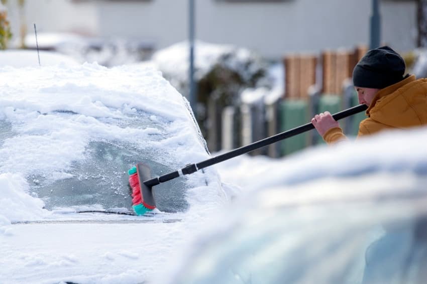
A cold front from Scandinavia is forecasted to approach the Alpine region by Wednesday, bringing along rain and snow once more, weather services alerted.
This unsettled weather pattern, characterised by stormy conditions, is anticipated to persist into the Christmas period, likely marked by significant precipitation and strong winds, particularly on Friday and Saturday.
#Österreich, Vorarlberg: #Schnee für die Berge in Sicht! Bis in die Nacht auf Freitag fallen mit einer West-, bis Nordweststaulage in Lagen oberhalb von 1200 bis 1500m vom Kleinwalsertal über die Tannberg-Region bis ins Montafon 30 bis 65 cm. /CG https://t.co/V0uwsJCJk1
— Alpinwetter | kachelmannwetter.com (@Alpinwetter) December 19, 2023
Wednesday is expected to be cloudy with intermittent rain, especially on the northern side of the Alps. The snow line will decrease to around 1000 meters in the Alps and down to 500 meters in regions such as Inn and Mühlviertel.
Some valleys, like the Enns and Salzach, might initially experience freezing rain. Showers are likely in the east, while in the south and southeast, occasional light rain may occur, potentially leading to slippery roads, the weather service warned.
READ ALSO: Will Austria see a white Christmas this year?
The Danube region will experience strong winds, becoming stronger and gusty at times along the eastern edge of the Alps.
During the early hours, the Austrian Severe Weather Center (Österreichische Unwetterzentrale) raised weather warning levels due to a strong storm, especially noticeable in Vienna. Lower Austria, on the other hand, received warnings of "freezing rain." Advance warnings were issued for Salzburg, Burgenland, and Styria.
Thursday will remain cloudy, with intermittent rain or snow mainly on the northern side of the Alps. The snow line will range from 600 meters in the Mühlviertel to 1,100 meters in the Alps. Occasional rain is expected in the east, while the southern regions, especially East Tyrol and Carinthia, might see rare sunshine. Strong, gale-force westerly winds are predicted from the Danube region across the Vienna Basin to northern Burgenland.
READ ALSO: How to stay safe during the ski season in Austria
Friday is anticipated to have cloudy and wet conditions, especially along the Alps, with the snow line varying between 600 and 1,000 meters. Heavier snowfall is expected at higher altitudes. Westerly winds will intensify, resulting in gale-force gusts, particularly in exposed north and east areas, along with windy conditions in many valleys.
Comments
See Also
A cold front from Scandinavia is forecasted to approach the Alpine region by Wednesday, bringing along rain and snow once more, weather services alerted.
This unsettled weather pattern, characterised by stormy conditions, is anticipated to persist into the Christmas period, likely marked by significant precipitation and strong winds, particularly on Friday and Saturday.
#Österreich, Vorarlberg: #Schnee für die Berge in Sicht! Bis in die Nacht auf Freitag fallen mit einer West-, bis Nordweststaulage in Lagen oberhalb von 1200 bis 1500m vom Kleinwalsertal über die Tannberg-Region bis ins Montafon 30 bis 65 cm. /CG https://t.co/V0uwsJCJk1
— Alpinwetter | kachelmannwetter.com (@Alpinwetter) December 19, 2023
Wednesday is expected to be cloudy with intermittent rain, especially on the northern side of the Alps. The snow line will decrease to around 1000 meters in the Alps and down to 500 meters in regions such as Inn and Mühlviertel.
Some valleys, like the Enns and Salzach, might initially experience freezing rain. Showers are likely in the east, while in the south and southeast, occasional light rain may occur, potentially leading to slippery roads, the weather service warned.
READ ALSO: Will Austria see a white Christmas this year?
The Danube region will experience strong winds, becoming stronger and gusty at times along the eastern edge of the Alps.
During the early hours, the Austrian Severe Weather Center (Österreichische Unwetterzentrale) raised weather warning levels due to a strong storm, especially noticeable in Vienna. Lower Austria, on the other hand, received warnings of "freezing rain." Advance warnings were issued for Salzburg, Burgenland, and Styria.
Thursday will remain cloudy, with intermittent rain or snow mainly on the northern side of the Alps. The snow line will range from 600 meters in the Mühlviertel to 1,100 meters in the Alps. Occasional rain is expected in the east, while the southern regions, especially East Tyrol and Carinthia, might see rare sunshine. Strong, gale-force westerly winds are predicted from the Danube region across the Vienna Basin to northern Burgenland.
READ ALSO: How to stay safe during the ski season in Austria
Friday is anticipated to have cloudy and wet conditions, especially along the Alps, with the snow line varying between 600 and 1,000 meters. Heavier snowfall is expected at higher altitudes. Westerly winds will intensify, resulting in gale-force gusts, particularly in exposed north and east areas, along with windy conditions in many valleys.
Join the conversation in our comments section below. Share your own views and experience and if you have a question or suggestion for our journalists then email us at [email protected].
Please keep comments civil, constructive and on topic – and make sure to read our terms of use before getting involved.
Please log in here to leave a comment.